Description
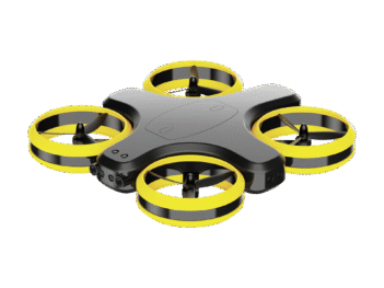
SPINNER EOD
AUTONOMOUS DRONE FOR EXPLOSIVE HAZARD DETECTION
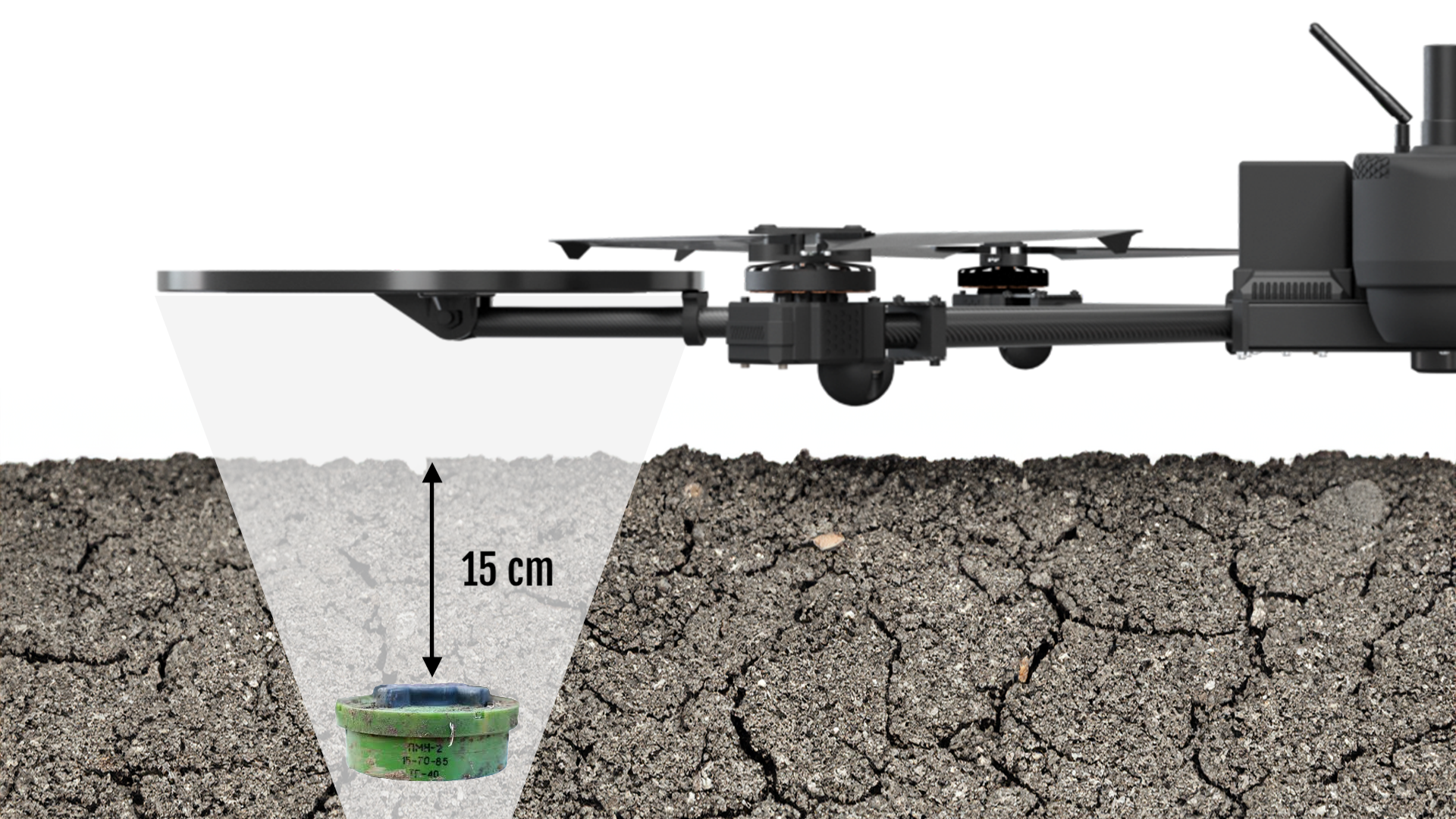
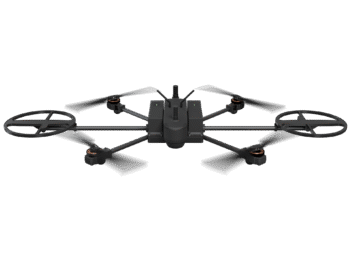
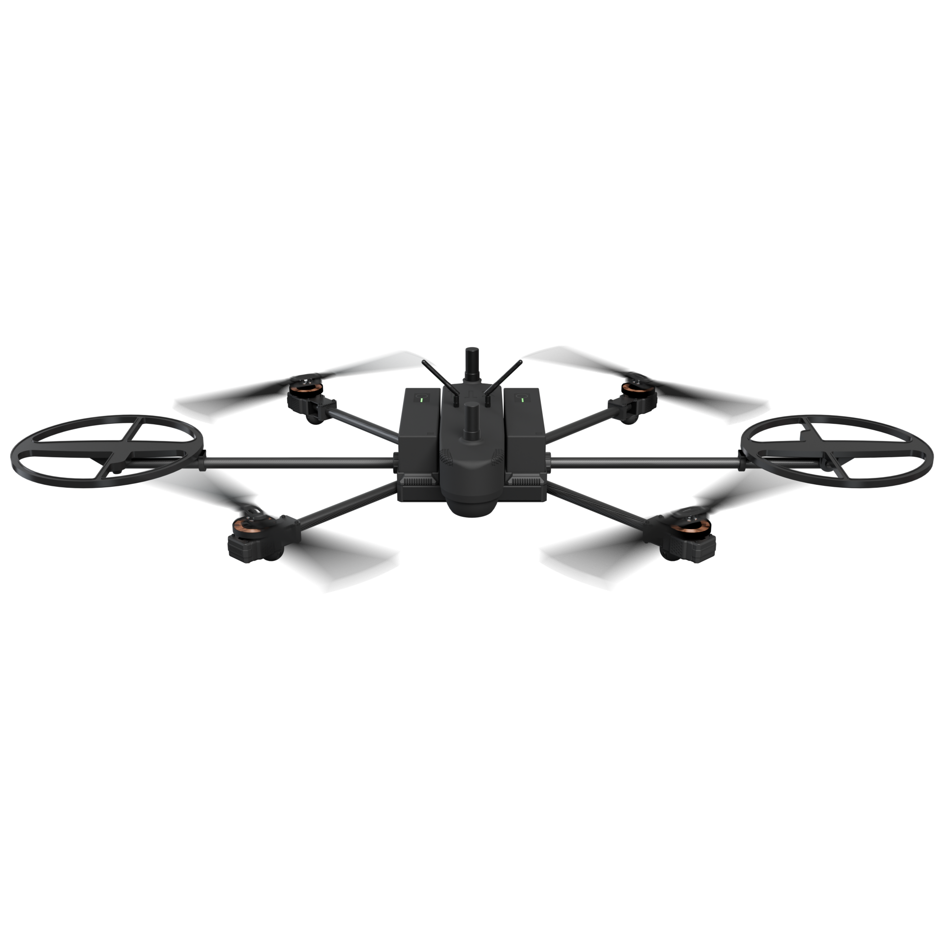
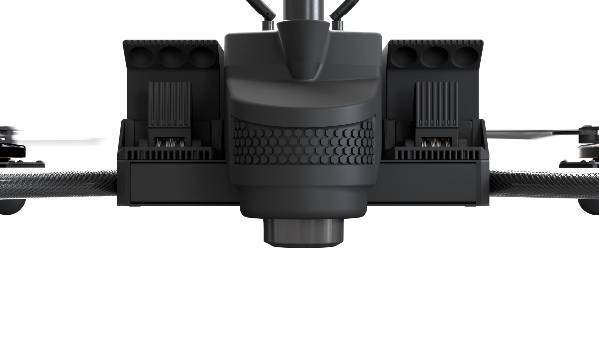
Subsurface Detection
Equipped with a dual metal detector search coil, Spinner (formerly ST1) delivers subsurface detection with human-level precision and accuracy. It is capable of detecting low-metal-content landmines, such as the PMN-2, buried at depths of up to 15 cm – fully meeting the performance requirements of top-class handheld metal detectors.
Spinner Scan Algorithm
The Spinner Scan Algorithm is a patented combination of rotation and forward motion on the drone. It enables scanning of wide lanes – up to 1.5 m – in a single pass with human-level accuracy. With built-in redundancy, each point is scanned multiple times at different angles by both coils, effectively eliminating the impact of electromagnetic noise and maximizing detection sensitivity.
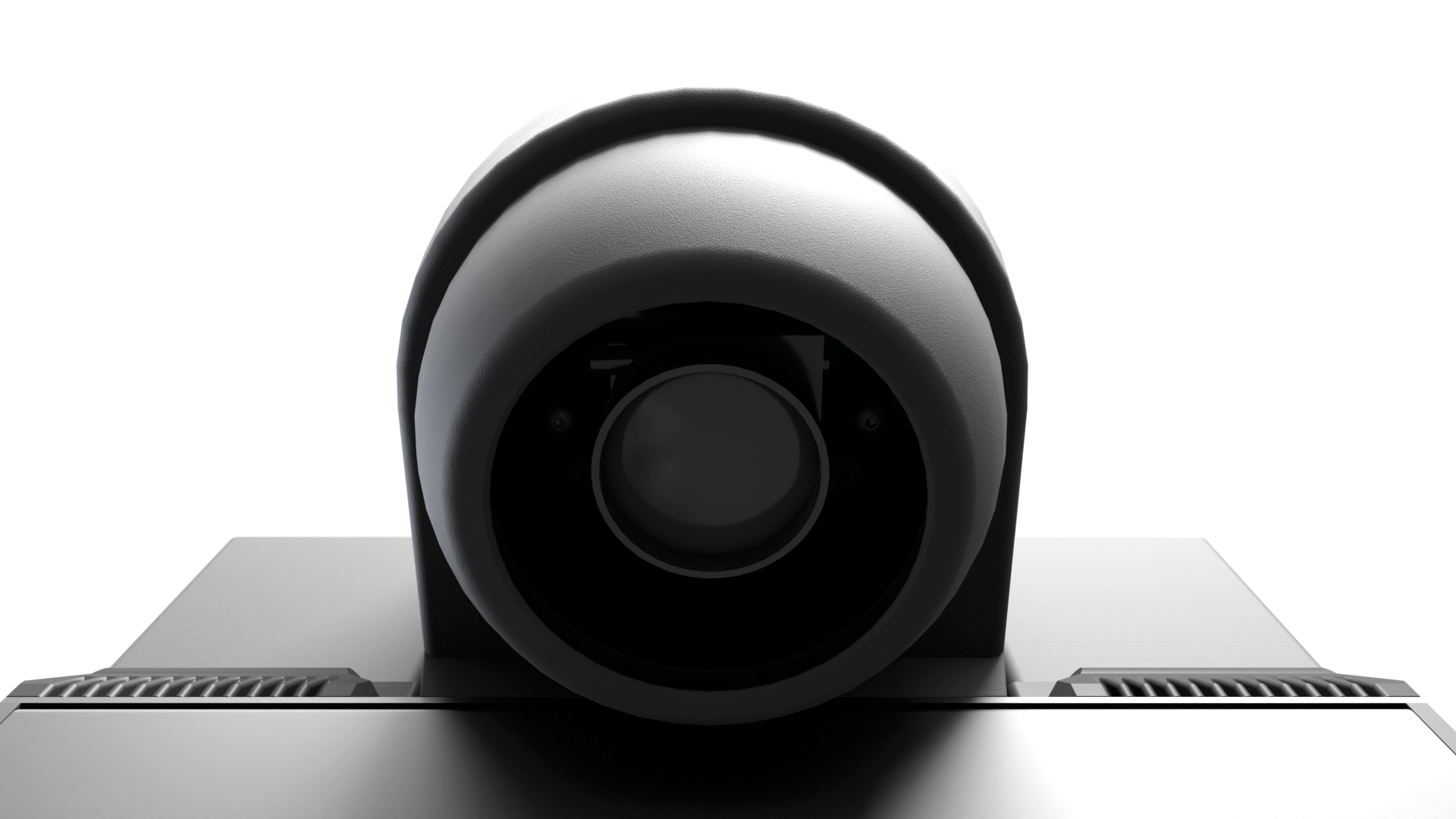
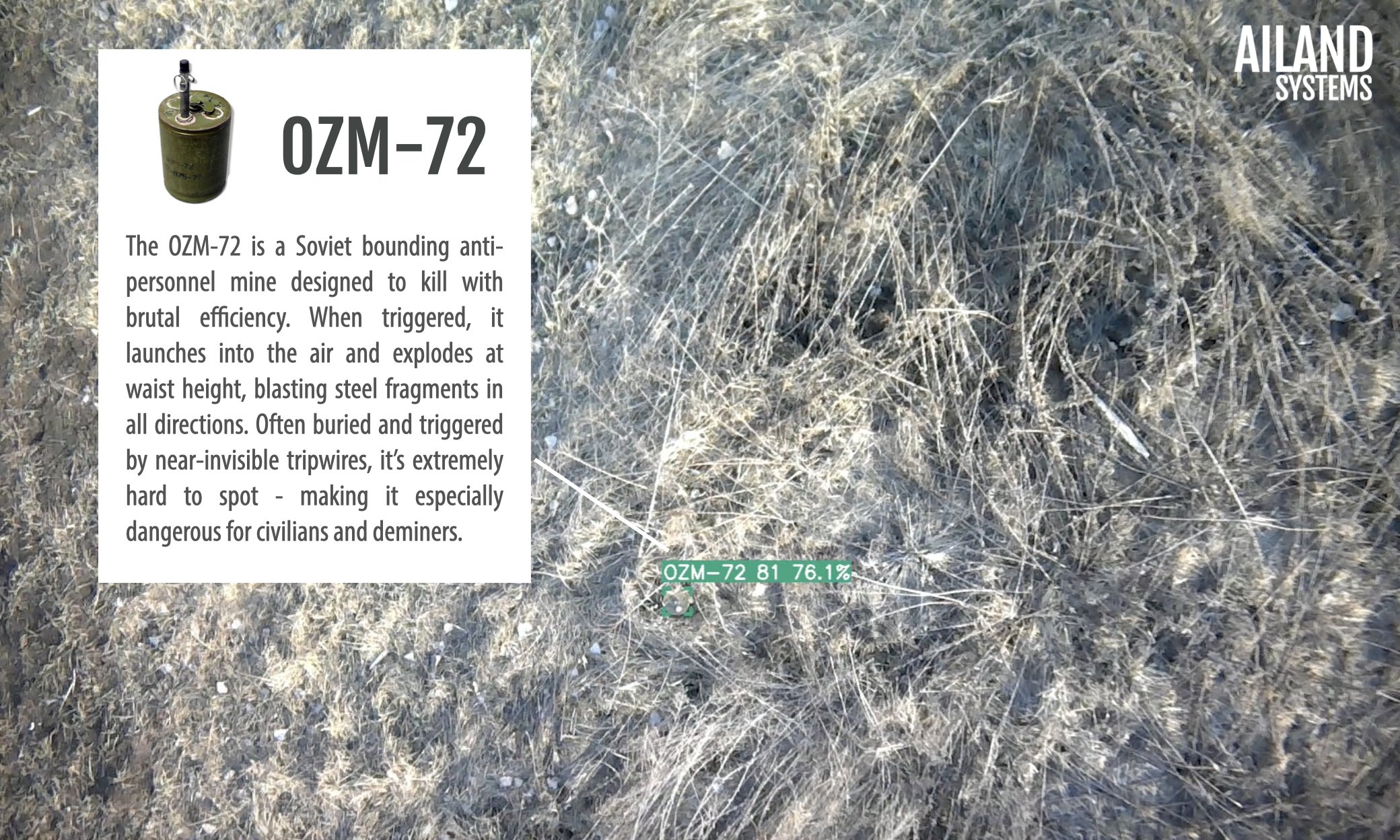
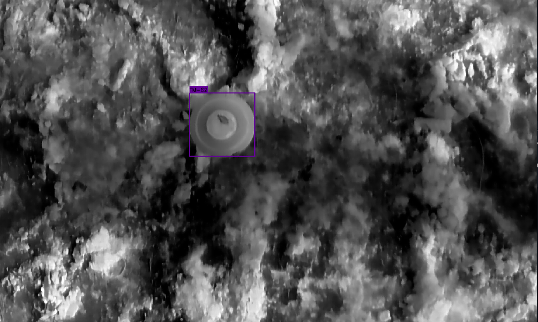
Visual Detection
The multispectral camera enables detection of surface-laid objects using the visible RGB spectrum during daytime and the NIR spectrum at night. In both cases, detections are performed and reported immediately, in real time. This is made possible by a proprietary AI model trained on over 400,000 labeled images of the most common landmine types – and continuously growing.


Full Autonomy
Spinner uses 360° LiDAR, camera, and distance sensors for situational awareness and automated obstacle avoidance – essential when flying at low altitudes. Combined with accurate battery state-of-charge monitoring, it provides everything required for fully autonomous operation: no manual control needed – the drone will complete its mission and return home automatically.
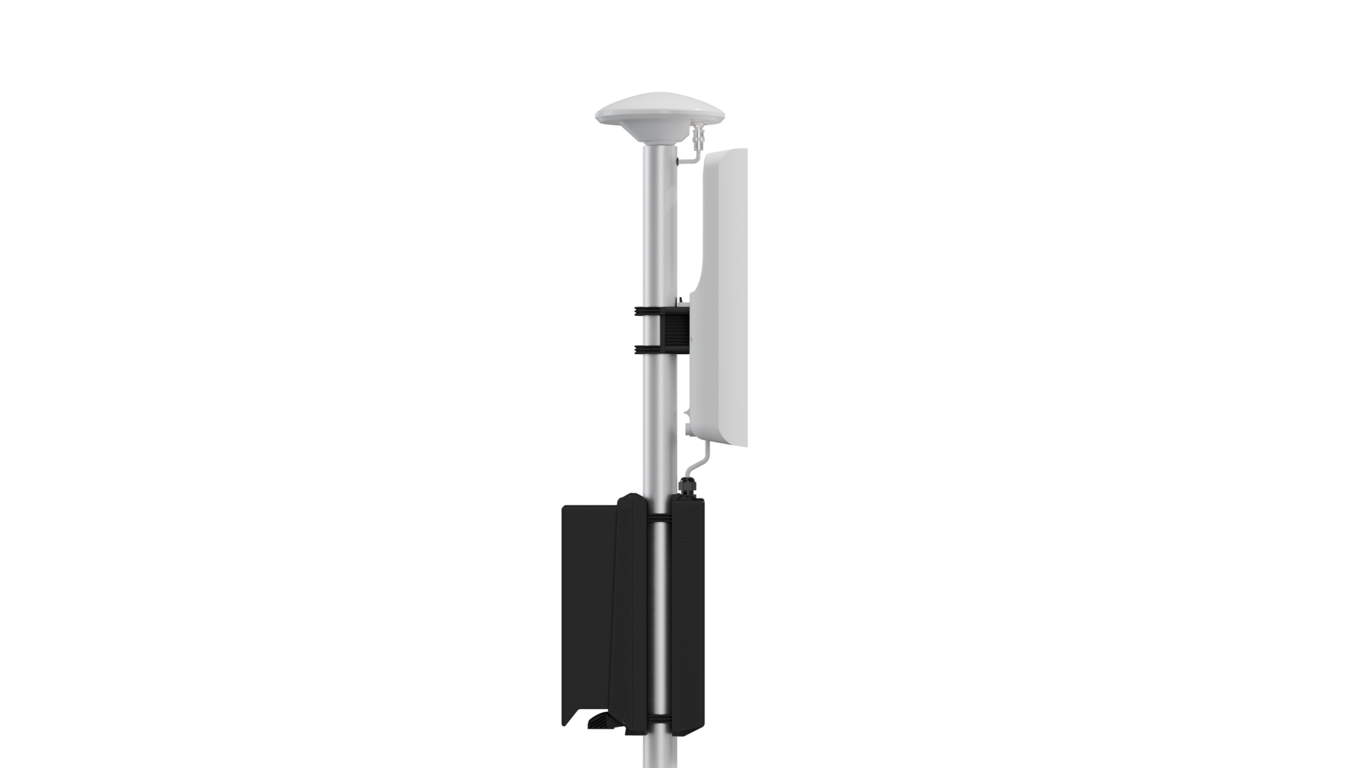
Precise Localization
When paired with the RTK Base Station, Spinner achieves high-precision positioning, localizing all detected objects with centimeter-level accuracy.
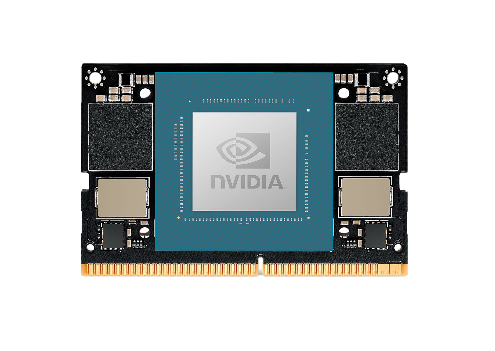
Real-Time Detection
Thanks to its powerful NVIDIA compute module, Spinner delivers detection results instantly, right in the air. No waiting – see the results before the drone even lands.
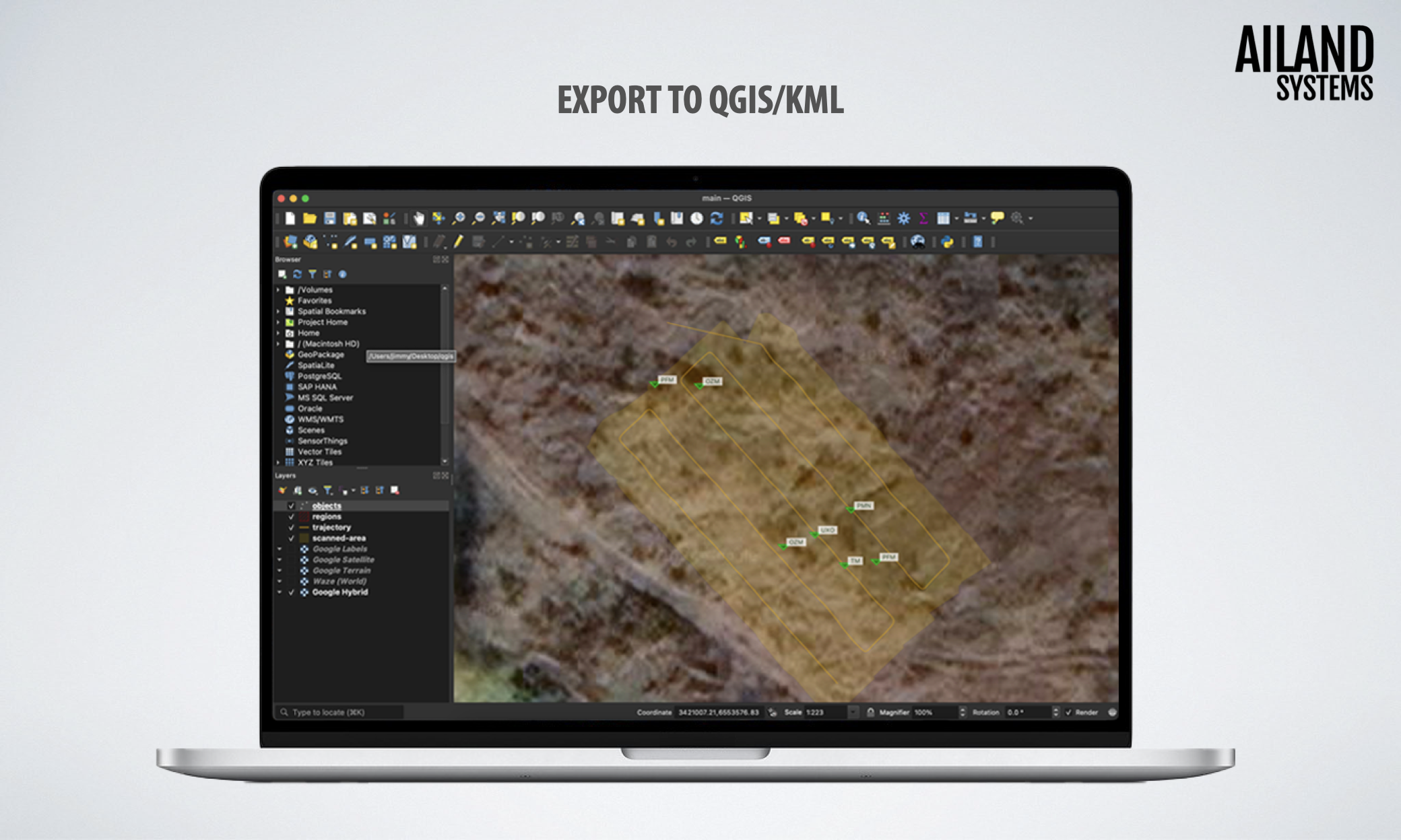
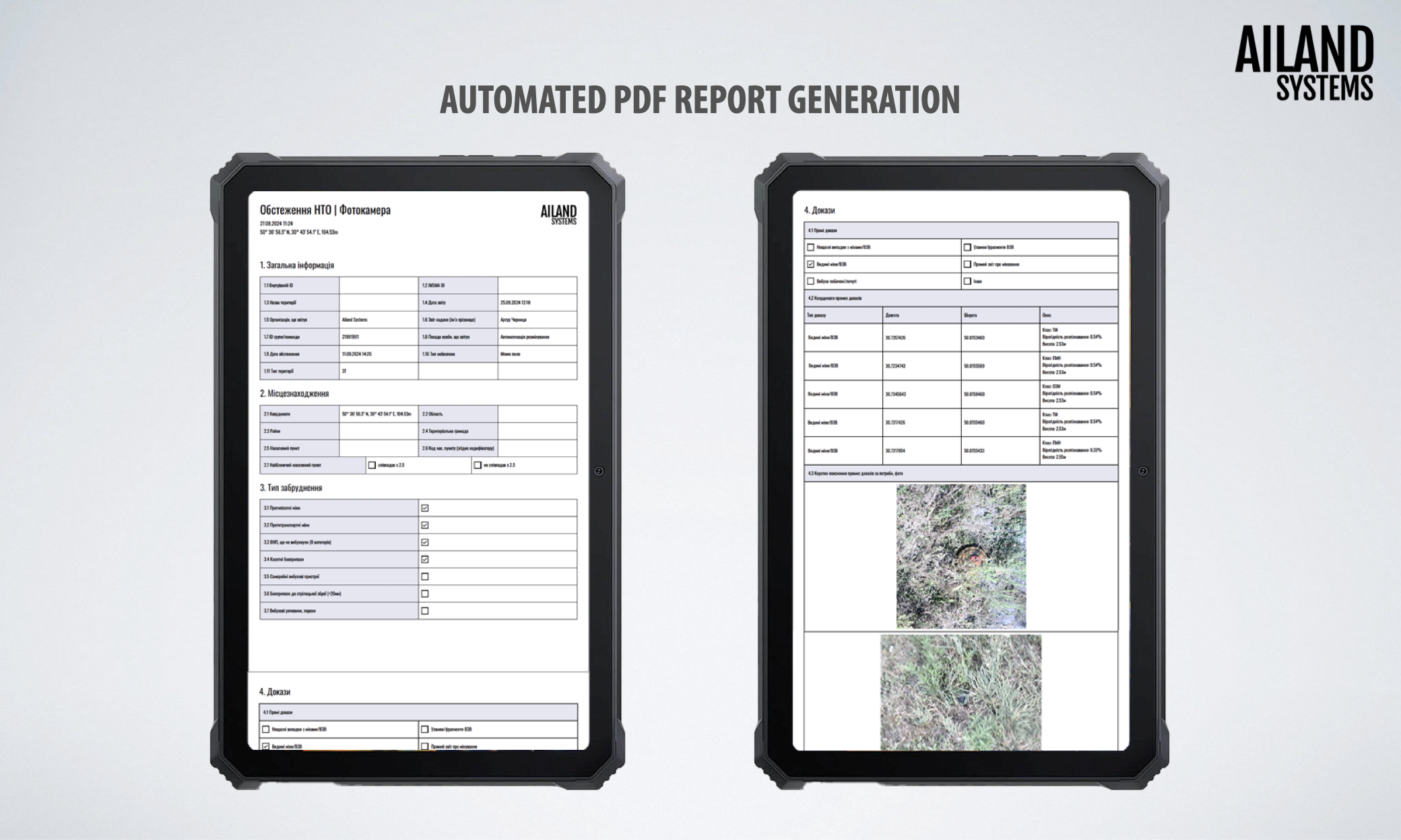
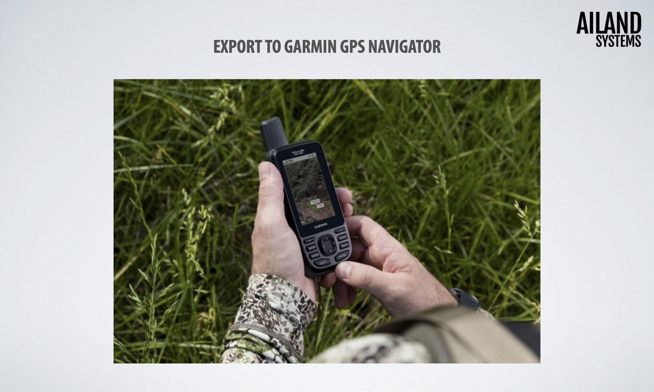
Software Tailored for Demining
Spinner produces reports compliant with international demining standards. Reports can be generated in the IMSMA template or exported to KML, compatible with QGIS and ArcGIS. Additional options include GeoJSON, Shapefile, or direct transfer to pocket GNSS devices.
See it in Action
Media Mentions


Specs
| Dimensions | 123x160x22 cm |
| Weight | 8.81 kg |
| Flight Time | 30 minutes |
| Max Detection Altitude | Camera (visual detection): 600 cm Metal detector (high metal content): 70 cm Metal detector (low metal content): 20 cm |
| Detection Performance | Camera: 2.0 ha/h Metal detector: 0.3 ha/h |
| Scan Radius | 5 km |
| Positioning Accuracy | Up to 1 cm |
| Sensors | Multispectral camera Dual metal detector search coil |
| Operating Temperature | -5 °C to 40 °C (23 °F to 104 °F) |
| Protection Rating | IP55 |
| Output Formats | GNSS coordinates with map preview KML (IMSMA compatible) PDF report (by IMSMA template) GeoJSON, Shapefile, JSON Garmin |
| Other Features | Obstacle avoidance Real time detection Real time visualization Swarm scan (multiple drones) |
| Price | $14,900.00 |